
Hilton Head Island Facts: What County Is Hilton Head In?
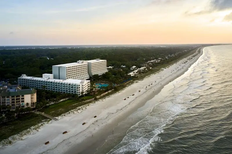
Hilton Head Island is in Beaufort County, South Carolina, 40 miles from Savannah: about 12 miles long and 5 wide, with 37,661 people in 2020.
What County Is Hilton Head In, and Where Is It?
| Fact | Answer |
|---|---|
| State | South Carolina |
| County | Beaufort County |
| Town incorporated | 1983 |
| Population (2020 census) | 37,661 |
| Island size | About 12 miles long and 5 wide; about 42 square miles of land |
| Town limits | 69.13 square miles, 41.35 of land and 27.78 of water |
| Time zone | Eastern Time, with daylight saving time |
| Nearest cities | Savannah, about 40 miles; Charleston, about 105 |
Hilton Head Island is located in Beaufort County, the southernmost county on the South Carolina coast, at the mouth of Port Royal Sound. The county seat is the town of Beaufort, about an hour north. To the west, across the Intracoastal Waterway, is Bluffton; to the southwest, across Calibogue Sound, is Daufuskie Island and then the Savannah River and Georgia.
From the island’s location, Savannah is about 40 miles away and Charleston about 105. Hilton Head is not in North Carolina, a common mix-up: see is Hilton Head in North Carolina? The Hilton Head Island map shows the beaches and communities.
Hilton Head Island is in the Eastern time zone, the same as New York, Atlanta and the rest of South Carolina. Clocks go forward an hour in March and back in November for daylight saving time.
How Big Is Hilton Head Island?
The island is about 12 miles long and about 5 miles across at its widest, shaped like a shoe, with about 42 square miles of land. The town’s official limits are bigger, 69.13 square miles, because they take in the creeks, marsh and water around the island: 41.35 square miles of land and 27.78 of water.
Hilton Head Island Population and Demographics
The 2020 census counted 37,661 people in the Town of Hilton Head Island, which was incorporated in 1983. The population is older than the state average, with many retirees, alongside families and the people who work in the resorts, restaurants and shops. In summer the island holds many more people than that, as visitors fill the rentals and hotels.
Who Owns Hilton Head Island?
No one person or company owns Hilton Head Island. It is a town, the Town of Hilton Head Island, and its land belongs to the thousands of homeowners and businesses who hold the deeds. The Town owns the public beach parks, parks and bike paths. About 70 percent of the island lies inside private planned communities such as Sea Pines, Palmetto Dunes and Shipyard, many of them gated, and each has its own property owners’ association that runs its roads, gates and common land. The beach itself is public up to the high-water mark, as on every South Carolina beach.
The island has nothing to do with Hilton hotels: the name is more than 350 years older (see how Hilton Head got its name). It did once have a few big owners. Two New York financiers, Alfred Loomis and Landon Thorne, held about two-thirds of it as a hunting preserve until 1950, when the Hilton Head Company, a timber venture led by Gen. Joseph Fraser and Fred Hack, bought their land. Fraser’s son Charles began building Sea Pines in 1956, and the island was sold off from there into the communities and lots it is today. Gullah Geechee families, whose land goes back to the years after the Civil War, still own land across the island. See Hilton Head history.
How Hilton Head Got Its Name
The island takes its name from Captain William Hilton, who sailed here in 1663 to scout land for planters in Barbados. The high bluff he marked at the entrance to Port Royal Sound became known as Hilton’s Head. See William Hilton and Hilton Head history.
The Hilton Head Bridge
Until 1956 the island was reached only by boat. That year a swing bridge opened over Skull Creek, and in 1982 the J. Wilton Graves Bridge replaced it: the fixed span that carries US 278 onto the island today, named for a former state highway commissioner who ran the island’s first motel. See getting to Hilton Head.
What Is Hilton Head Island Known For?
Hilton Head is known for 12 miles of wide beaches, 20 golf courses and the PGA Tour’s RBC Heritage at Harbour Town, more than 60 miles of public bike paths, and resort communities such as Sea Pines and Palmetto Dunes. It also has deep Gullah Geechee roots, strict sign rules that keep out billboards and neon, and a lot of dolphins.
Is Hilton Head Island Safe? The Crime Rate
| Crime (2024, FBI data) | Per 1,000 residents |
|---|---|
| Violent crime | 3.72 |
| Property crime | 16.72 |
Hilton Head is a busy resort town, and most of what is reported is property crime, such as theft from cars and shoplifting, rather than violent crime. NeighborhoodScout’s reading of the FBI’s 2024 figures puts the violent crime rate at 3.72 per 1,000 residents and the property crime rate at 16.72. Rates are counted per resident, and the island holds many more people in summer than live here year-round, so the rates look higher than they would for a town with no visitors.
The Town has no police department of its own: Beaufort County Sheriff’s deputies patrol the island (see police, fire and EMS on Hilton Head), and gated communities add their own security. Town and Sheriff’s officials report an increase in incidents involving teens and young adults over the past three years, mostly late at night around Coligny Beach, and the Town began installing and upgrading about 60 cameras in the Coligny area in July 2026.
For a visit, the everyday risks are the ordinary ones. Lock your car and keep valuables out of sight, lock your bike, swim near a lifeguard (see rip currents), and leave alligators alone. Call 911 in an emergency.
Hilton Head Island Elevation
Hilton Head is a low, flat barrier island. Researchers at Western Carolina University’s Program for the Study of Developed Shorelines describe its average elevation as low and measure mean high water at just 3.75 feet, which is why the island is so exposed to sea-level rise.
On low ground like this, storm surge is the main danger in a hurricane (see Hilton Head hurricanes). Flood zones are mapped address by address, so if you are buying, or choosing a rental near the water, look up the address on FEMA’s flood map at msc.fema.gov.
Is Hilton Head Expensive?
Is Hilton Head expensive? It can be in summer, when rentals and hotels charge their highest rates. Spring and fall are cheaper and still warm, and winter is the cheapest of all; see the best time to visit Hilton Head. Free things help: the beach parks, the bike paths and the sunsets cost nothing.
Is there a casino on Hilton Head? No. South Carolina does not allow casinos on land, and the nearest gambling is on casino boats out of Brunswick, Georgia, and Little River; see is there a casino in Hilton Head?
Watch: Where Is Hilton Head Island? Map, Size and Distances
Hilton Head Island is in South Carolina, at the southern tip of the state’s coast in Beaufort County, about 40 miles from Savannah, Georgia (about an hour) and about 105 miles from Charleston (about two hours). Bluffton, across the bridges, is a separate town on the mainland.
Frequently Asked Questions
Updated
What county is Hilton Head in?
Beaufort County, South Carolina. The county seat is the town of Beaufort, about an hour north.
What state is Hilton Head in?
South Carolina. Hilton Head Island is at the southern tip of the South Carolina coast, about 40 miles from Savannah, Georgia.
Is there a difference between Hilton Head and Hilton Head Island?
No. Hilton Head is the everyday short name for Hilton Head Island, and the town on it is officially the Town of Hilton Head Island. Bluffton, across the bridge on the mainland, is a separate town.
What does HHI stand for?
Hilton Head Island. HHI is the everyday shorthand for the island, used by islanders, local businesses and HHI.com, the local guide to Hilton Head Island.
Is Hilton Head an island?
Yes. Hilton Head Island is a low barrier island between Port Royal Sound and Calibogue Sound, about 12 miles long. Since 1956 it has been joined to the mainland by bridge; the J. Wilton Graves Bridge carries US 278 over Skull Creek onto the island.
What is Hilton Head Island known for?
Its 12 miles of wide beaches, 20 golf courses and the PGA Tour’s RBC Heritage at Harbour Town, more than 60 miles of public bike paths, and resort communities such as Sea Pines and Palmetto Dunes. It also has deep Gullah Geechee roots, strict sign rules that keep out billboards and neon, and a lot of dolphins.
How big is Hilton Head Island?
About 12 miles long and 5 miles wide, with about 42 square miles of land. The town limits, which include the surrounding water and marsh, cover 69.13 square miles.
What is the population of Hilton Head Island?
37,661 at the 2020 census. The island holds many more people in summer, when visitors fill the rentals and hotels.
How has Hilton Head’s population changed?
It grew fast, then leveled off. The census counted 23,694 people in 1990, 33,862 in 2000, 37,099 in 2010 and 37,661 in 2020.
Who owns Hilton Head Island?
No single owner. It is a town, and its land belongs to the homeowners and businesses who hold the deeds, with the Town owning the public beach parks and bike paths. About 70 percent of the island lies in private planned communities such as Sea Pines and Palmetto Dunes, each run by its own property owners’ association.
What time zone is Hilton Head in?
Eastern Time, the same as New York and Atlanta. The island observes daylight saving time.
How did Hilton Head get its name?
From Captain William Hilton, who sailed here in 1663. The headland he marked at the entrance to Port Royal Sound became Hilton’s Head.
What is the bridge to Hilton Head called?
The J. Wilton Graves Bridge, which carries US 278 over Skull Creek onto the island. It opened in 1982, replacing a 1956 swing bridge.
Your beach week starts here
Compare villa and beach home prices from local rental companies side by side, and catch last-minute deals before they’re gone.
Property manager? Partner with us